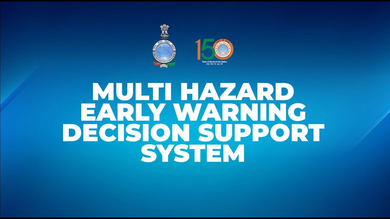
A Digital Transformation in Forecasting and Disaster Risk Reduction
Key Takeaways
- Multi-Hazard Early Warning Decision Support System (MHEW-DSS) enables a full digital shift from fragmented forecasting to an integrated, automated forecasting.
- Impact-based, location-specific warnings now reach nearly 80% of the population across India and neighbouring regions.
- Real-time forecasting and impact-based warnings have reduced forecast preparation time by 50% and improved forecast accuracy by 30%.
- The implementation of MHEW-DSS has reduced evacuation costs to one third from 1999 to 2024 due to a reduction in cyclone landfall point forecast error in the 3-5 days ahead forecast issued by IMD.
Introduction
India is highly vulnerable to extreme weather events such as cyclones, floods, heatwaves, droughts, and landslides due to its diverse geography, long coastline, and monsoon-dependent climate. According to the India Meteorological Department (IMD) and the Ministry of Earth Sciences, India experiences hundreds of extreme weather events every year, with floods affecting nearly 40 million hectares of land and heatwaves becoming more frequent in recent decades. Over 75% of India’s districts are exposed to multiple climate hazards, while cyclones and floods alone account for the majority of disaster-related losses, according to the Council on Energy, Environment and Water (CEEW). In this context, the in-house development of a Multi-Hazard Early Warning Decision Support System (MHEW-DSS) is a timely and strategic step, as accurate forecasting and integrated risk analysis significantly reduce disaster losses, enable early evacuation and preparedness measures, and strengthen public safety by translating complex meteorological data into actionable warnings for governments, communities, and emergency responders.
Core Objectives of the MHEW-DSS
The MHEW-DSS is an advanced digital forecasting platform developed by the IMD using open-source technology and in-house expertise. Introduced as a landmark digital transformation initiative under Mission Mausam, the system strengthens India’s real-time weather monitoring and early warning capabilities.
The MHEW-DSS was officially launched in January 2024 and operates in real time using tools such as Geographic Information System (GIS) maps, enabling forecasters to quickly collect, analyse, and disseminate weather information in a clear and user-friendly manner. By integrating different observational data including satellite, and radar data and modern forecasting tools, the system delivers faster and more reliable early warnings and provides sector-specific alerts for farmers, transport services, fishermen, energy providers, and the tourism sector.
The primary objective of the MHEW-DSS is to build an integrated and indigenous forecasting system capable of delivering accurate, real-time, and impact-based multi-hazard forecast across India. The system is designed to empower forecasters, decision-makers, and communities by improving information flow and enabling timely early warnings. Through these capabilities, the system supports impact-based forecasting and risk-based warnings, allowing IMD forecasters to translate complex meteorological data into actionable information for users. This approach strengthens disaster preparedness and enhances public safety by ensuring that early warning information is accessible, reliable, and relevant for different sectors and communities.
| Salient Features of the MHEW-DSS
🛰️Automated Weather Data Processing: Over 90% of weather data collection, quality checks, and integration are automated, enabling faster detection of weather systems and their possible impacts. 📊Better Use of Forecast Models: More than 95% of numerical weather prediction model inputs are now used in forecasting, improving risk assessment for different weather hazards. ⚙️Re-engineered Forecasting System: The entire forecasting and warning generation process has been re-engineered, enabling real-time alerts and faster decision-making. 📅Longer Forecast Lead Time: Forecast lead time has increased from 5 days to 7 days, allowing authorities and communities to prepare in advance. ⏱️Faster Forecast Preparation: The time required to prepare forecasts has reduced by about 3 hours from 6 hours, enabling quicker dissemination of warnings. 💰Cost Savings and Self-Reliance: The system has generated around ₹250 crore in cost savingsand eliminated dependence on foreign vendors, strengthening India’s technological self-reliance. 🌪️Effective Cyclone Forecasting: Accurate forecasts during Cyclone Biparjoy and Cyclone Danaenabled timely evacuation, resulting in zero casualties in Gujarat and Odisha. 🚨Reduced Evacuation Costs: Improved early warnings have helped reduce evacuation costs to one third from 1999 to 2024 due to a reduction in cyclone landfall point forecast error in the 3-5 days ahead forecast issued by IMD. |
| The MHEW-DSS reflects the Government of India’s vision of a “Weather Ready and Climate Smart Nation” and embodies the philosophy of “Har Har Mausam, Har Ghar Mausam,” ensuring that timely and actionable weather information reaches every household, sector, and region.
Institutional Framework Supporting the MHEW-DSS The Multi-Hazard Early Warning Decision Support System (MHEW-DSS) is a state-of-the-art application developed in-house by the India Meteorological Department under the Mission Mausam initiative. It is a webGIS-based digital platform designed to generate weather forecasts, handle large volumes of meteorological data, and deliver timely weather alerts. As part of this system, several sector-specific geospatial applications have been developed. One such application, Mausamgram, enables last-mile dissemination of hyper-local weather forecasts, ensuring that vital weather information effectively reaches citizens and weather-dependent sectors.
The MoES is the nodal ministry of the Government of India that provides operational services and scientific research to monitor, forecast, and understand atmospheric and oceanic processes for public safety and national development. It oversees key institutions such as the India Meteorological Department and other forecasting and research centres that support weather and climate services across the country.
Established in 1875, the IMD serves as the principal government agency responsible for meteorology and allied sciences. It conducts systematic weather observations and provides current and forecast meteorological information to support weather-sensitive sectors such as Disaster Risk Reduction, agriculture, power, renewable energy, environment, health, water, irrigation, surface transport, shipping, aviation, and onshore and offshore industries, and tourism, etc. Under the MHEW-DSS, IMD plays a central operational role by generating real-time forecasts and alerts through integrated digital systems.
Approved by the Union Cabinet in September 2024, Mission Mausam is a flagship initiative aimed at strengthening weather forecasting and early warning capabilities across the country. The mission aims to enhance the accuracy, resolution and lead time of forecasts for extreme weather events such as cyclones, heavy rainfall and heat waves. Within the MHEW-DSS, the mission strengthens the scientific and technological backbone of forecasting by improving observation networks, data assimilation and modelling capabilities, enabling timely weather alerts for effective disaster preparedness. Did you know? Launched in January 2024, Mausamgram is a web-based, hyper-local weather forecasting portal developed by the IMD under the MoES. The platform delivers location-specific forecasts up to 10 days covering more than 1.5 lakh pin codes, 5,700 blocks, and over 6.2 lakh villagesacross India. Accessible through the IMD website, the Mausam mobile app, the SACHETplatform, e-Panchayat Seva, and APIs, the portal ensures wide public and institutional access. It provides hourly forecasts up to 36 hours, 3-hourly forecasts up to 5 days, and 6-hourly forecasts up to 10 days, helping improve planning, preparedness, and early response to weather events. Based on the Mausamgram, the forecaster reaches out to anyone in the country and the north Indian ocean region, including fishermen, farmers, in collaboration with the central and state Ministry of Agriculture, to Krishi Sakhi & Pashu Sakhi through the Ministry of Rural Development, and to ward members, sarpanch, and panchayat secretary through the Ministry of Panchayati Raj. Together, these institutions and platforms form the operational backbone of the MHEW-DSS ecosystem. Their combined capabilities in observation, modelling, and digital dissemination strengthen India’s ability to deliver accurate, location-specific forecasts and timely early warnings, improving disaster preparedness and supporting weather-sensitive sectors across the country. |
Operational Architecture of the MHEW-DSS
MHEW-DSS combines large amounts of weather data and automates forecasting by re-engineering the entire workflow.
It enables efficient data collection by gathering real-time inputs from multiple sources such as radars, automatic weather stations, satellites, ship and ocean buoys. The system standardises and processes this information on a unified platform, supporting advanced data analysis and data visualisation for better understanding of weather patterns. Through multi-model integration and consensus forecasting, it compares model outputs with observations, selects the best-performing models, and applies ensemble techniques and bias correction to improve accuracy, especially during extreme events. These insights support timely decision-making, enable faster warning preparation, and ensure effective information dissemination to stakeholders and the public.
At the core of the system is the Weather Analysis and Forecast Enabling System (WAFES), which helps forecasters analyse data, generate charts, and visualise weather conditions through GIS-based maps. MHEW-DSS has replaced the earlier manual forecasting approach and allows meteorologists to compare real-time observations with model outputs to prepare accurate weather forecasts.
Another key feature of the MHEW-DSS is its focus on impact-based forecasting and risk-based warnings. It means instead of only predicting weather conditions, the MHEW-DSS also assesses how severe weather may affect sectors such as agriculture, health, energy, transport, and infrastructure etc. The system provides easy-to-understand colour-coded warnings to indicate different levels of risk. Through GIS-enabled platform, it brings together alerts for multiple hazards such as cyclone, heavy rainfall, heatwave, thunderstorm/lightning and marine conditions. Once forecasts are prepared, warnings get shared with authorities and public through digital platforms, SMS, emails, Application Programming Interface (API), Mobile App (Mausam), Common Alerting Protocol (CAP) and graphical bulletins, enabling timely action and improving disaster preparedness.
By combining real-time observations with advanced modelling tools, the platform improves the accuracy, speed and clarity of weather forecasts and warnings. Its ability to translate scientific data into risk-based advisories enables authorities, sectoral agencies and communities to take timely preventive action, strengthening disaster preparedness and reducing the impact of extreme weather events.
Key System Characteristics of the MHEW-DSS Enabling Real-Time Weather Forecasting
The MHEW-DSS is designed as a robust, future-ready system that integrates technology, data, and institutional coordination to deliver effective early warning services. Its architecture reflects a focus on scalability, interoperability, and user-centric delivery, enabling seamless operations across sectors and geographies.
- Interoperable: Different modules work together on one platform, allowing easy sharing of data across ministries, departments, and sectors using common standards.
- Scalable: The system can easily grow over time—adding new data, technologies, regions, and types of disasters without major changes.
- Replicable: It is built using standard methods, making it easy to use in other sectors and even by other countries.
- Efficient: Real-time forecasts and impact-based warnings have reduced preparation time by 50% and improved accuracy by 30%.
- Responsive: The system is user-friendly and dynamic, sharing information through multiple channels such as SMS, APIs, mobile apps, and websites.
- Transparent: Clear data processes and open systems make it easy to track, verify, and ensure accountability.
- Sustainable: Supported by long-term planning, regular training, system upgrades, and continuous knowledge sharing.
Overall, system chrematistics make MHEW-DSS a practical and future-ready system that improves disaster preparedness and supports better decision-making.
Impact of the MHEW-DSS: Protecting Lives and Livelihoods through Preparedness
The MHEW-DSS strengthens early warning systems and delivers sector-specific advisories that help authorities, communities and industries to prepare for extreme weather conditions. By translating scientific forecasts into practical alerts, the system supports safety, public health, agriculture, energy management and disaster preparedness.
Cyclone and Marine Safety:
- Provides early warning for cyclones, storm surges, heavy rainfall, and rough sea conditions.
- Issues special alerts for fishermen when wind speed exceeds 45 kmph, seas become very rough, or squally weather is expected.
- Warnings are shared through SMS, WhatsApp, mobile apps, AIR, Doordarshan, and official websites.
- Frequent updates during cyclones help coastal communities and fishermen take timely safety measures.
Human Health:
- Supports heatwave forecasts and heat action plans to reduce heat-related illnesses.
- Helps authorities prepare cooling centres, hospital readiness, and emergency health responses especially for vulnerable groups such as women, children, and pregnant women during disasters.
- Weather data supports prediction of vector-borne diseases such as dengue and malaria, strengthens community health, nutrition, and resilience programmes.
- Air quality and temperature advisories help vulnerable populations take preventive measures.
Energy Sector:
- Provides solar radiation, wind, rainfall, and temperature forecasts for renewable energy planning.
- Supports solar, wind, and hydropower generation management.
- Early warnings help protect power infrastructure from extreme weather.
- Automation has reduced infrastructure costs and saves about 210,240 kWh of electricity annually.
Water Resource Management:
- Enables accurate rainfall forecasts, monsoon prediction, and drought warnings.
- Supports reservoir operations, flood control, irrigation planning, and groundwater management.
- Helps farmers use water more efficiently through agromet advisories.
- Digital workflows have saved around 63 kilolitres of water annually by eliminating paper chart production.
Environment Conservation:
- Supports climate monitoring, air quality forecasting, and natural resource management.
- Digital forecasting has eliminated manual chart plotting across 40 IMD offices.
- Saves 23.4 tonnes of paper annually, reducing environmental impact.
- Results in annual savings of about ₹1.40 crore and avoids 2.57 tonnes of CO₂ emissions.
Education and Capacity Building:
- Provides training programs for meteorologists and stakeholders on digital forecasting tools.
- Promotes weather and climate literacy through bulletins, maps, and online resources.
- Supports research and higher education by providing climate data and meteorological information.
- Helps stakeholders interpret forecasts for better decision-making and preparedness.
Sustainable Farming:
- Provides twice-weekly agromet advisories and crop-specific guidance for farmers.
- Helps farmers plan sowing, irrigation, and harvesting based on weather conditions.
- Farmers using advisories reported 52.5% higher annual income compared to those who did not adopt them.
- Economic benefits in rain-fed districts are estimated at ₹13,331 crore annually, if the crop weather advisories are reached to such farmers and used by them.
Livelihood Protection:
- Provides timely weather information to farmers, fishermen, transport workers, and daily wage earners.
- Helps communities protect assets, plan activities safely, and avoid weather-related losses.
- Strengthens livelihood security across agriculture, fisheries, tourism, and transport sectors.
Strengthening Governance:
- Introduces a fully digital forecasting workflow for data collection, analysis, and warning dissemination.
- Improves forecast accuracy, data sharing, and coordination among agencies.
- Reduces manual work and optimizes manpower across 40 forecasting offices.
- Digital transformation has resulted in annual manpower savings of about ₹57.6 crore.
- More than 200 organisations use the IMD’s application, including NITI Aayog and National Disaster Management Authority (NDMA).
Through timely forecasts, risk-based warnings, and sectoral advisories, the MHEW-DSS improves preparedness across communities and institutions. Its impact extends from protecting lives during disasters to supporting livelihoods, efficient resource management and informed governance. The system marks a step towards a more resilient and weather-ready India.
National and International Recognition of the MHEW-DSS
The MHEW-DSS represents a significant advancement in India’s approach to disaster risk management, combining technology, data, and institutional coordination. Its impact is reflected not only in strengthening domestic preparedness but also in enhancing India’s contribution to global early warning systems. Beyond its national impact, the system has enhanced regional cooperation, international meteorological collaboration, and technology-driven early warning services, reinforcing India’s role in global disaster risk reduction.
At the international level, MHEW-DSS has reinforced India’s role in regional and global disaster risk reduction frameworks. The system supports weather and climate services across the North Indian Ocean and the Asia-Pacific region, including marine advisories, aviation meteorology, and tropical cyclone forecasting under the World Meteorological Organization (WMO) and the Economic and Social Commission for Asia and the Pacific (ESCAP)/WMO Panel on Tropical Cyclones. As a Regional Specialized Meteorological Centre (RSMC), the IMD provides critical MHEW-DSS forecasting support and severe weather advisories to countries such as Bangladesh, Maldives, Myanmar, Oman, Pakistan, Qatar, Sri Lanka, Thailand, UAE, and Yemen, strengthening regional coordination and data sharing.
At the national level, MHEW-DSS has significantly enhanced disaster preparedness and response mechanisms. Currently, more than 200 organizations are using IMD’s application; it include key institutions such as the National Disaster Management Authority (NDMA), National Disaster Response Force (NDRF), and State Disaster Management Authorities (SDMA). The system enables timely forecasts and impact-based warnings, while also supporting sectoral stakeholders—such as urban planning agencies, power utilities, health services, and aviation—with actionable weather intelligence for improved decision-making.
The system has received notable national recognition, including the National Award for e-Governance 2025, the UN Office for Disaster Risk Reduction (UNDRR) Sasakawa Award for Disaster Risk Reduction (2025) awarded to Mr. Mruntyunjay Mohapatra, Director General of IMD, and the Award of Excellence at the Digital Transformation Summit 2026, recognising IMD’s innovation in public service delivery. The project has also been awarded The Economic Times GovTech Award 2026 under the category “Disaster Management & Public Safety Tech Award”.Top of FormBottom of Form
Together, these recognitions highlight the operational success of MHEW-DSS and its growing role in strengthening both national resilience and international cooperation in disaster risk management.
Conclusion
The Multi-Hazard Early Warning Decision Support System represents a decisive transformation in India’s approach to weather forecasting and disaster risk reduction. By integrating real-time observations, advanced modelling, GIS-based analysis, and structured dissemination within a single digital framework, the system converts weather and climate information into timely, preventive action.
MHEW-DSS has strengthened preparedness across environment, energy, health, agriculture, livelihoods, and governance. It has reduced loss of life, limited economic damage, improved service delivery, and enhanced public trust through consistent and impact-focused warnings. The system demonstrates how technology-driven early warning delivers measurable public value at the national-scale and positions India as a global leader in multi-hazard early warning systems.